Background
The Wisconsin Supreme Court has accepted a request to take up a case challenging the existing state legislative maps. Petitioners in the lawsuit make several arguments. Some of the arguments ask the court to find that “partisan gerrymandering violates” the state constitution’s “guarantee of equal protection,” as well as “free speech and association rights” and the “Maintenance of Free Government provision.”
Less ambitiously, perhaps, petitioners also argue that the “current legislative districts are unconstitutionally noncontiguous.” This argument, if accepted, could allow the court to throw out the current map without making reference to partisan advantage.
The relevant section of the Wisconsin Constitution is Article IV, Section 4, quoted below in its entirety (emphasis mine):
“[As amended Nov. 1881 and Nov. 1982] The members of the assembly shall be chosen biennially, by single districts, on the Tuesday succeeding the first Monday of November in even-numbered years, by the qualified electors of the several districts, such districts to be bounded by county, precinct, town or ward lines, to consist of contiguous territory and be in as compact form as practicable.”
Likewise, Senate districts are required to be composed of “convenient contiguous territory.”
Every square inch of land in Wisconsin is part of a city, town, or village, and many of those municipalities aren’t contiguous. In 1992, a federal court ruled that “literal contiguity” was not required by the state constitution. The judges wrote, “. . . [F]or the achievement of perfect contiguity and compactness would imply ruthless disregard for other elements of homogeneity; would require breaking up counties, towns, villages, wards, even neighborhoods. If compactness and contiguity are proxies for homogeneity of political interests, so is making district boundaries follow (so far as possible) rather than cross the boundaries of the other political subdivisions in the state.”
In other words, unconnected pieces of the same municipality could be placed into the same Assembly district. The 1992 ruling prioritized keeping municipalities intact over strict geographic contiguity.
In the early 1990s, it was Republicans, not Democrats, arguing for the enforcement of literal contiguity. Now, the roles are reversed. And, of course, the Wisconsin Supreme Court—not the federal district court then or any other federal court—has final authority as to the meaning of the Wisconsin constitution.
How many districts are noncontiguous?
Thus far, the specific contiguity-related statistics I’ve read have all been provided by the petitioners, who maintain that 55 Assembly and 21 Senate districts are noncontiguous. In support, their Memorandum of Law simply links to the legislative district maps provided by the Wisconsin Legislative Technology Services Bureau (see footnotes 1 and 21).
The remainder of this blog post is an explanation of an independent and repeatable method for measuring district contiguity across the state. My calculations yield slightly different results from those provided by the petitioners. While we both identify the same 21 Senate districts as being noncontiguous, I only find 52 Assembly districts with unconnected pieces.
Measuring contiguity
The basic building blocks of the current Assembly map are the census blocks used in the 2020 census. There are 203,059 total census blocks in the state of Wisconsin. Of those, 58,111 are unpopulated. Here’s what the statewide census block map looks like. We would need to zoom way in to clearly see the individual blocks in more populated areas. You can download this GIS file directly from the US Census Bureau here. It’s important to use the official Census Bureau GIS data because they are high quality and complete.
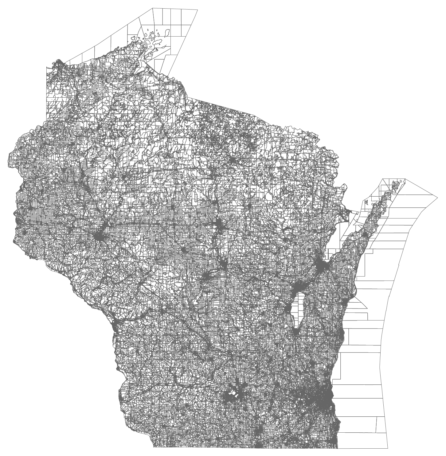
Notice the census blocks that just cover water. These aren’t actually assigned to an Assembly district, but everything else is. The files showing which census blocks constitute each state legislative district are available from the Census Bureau here.
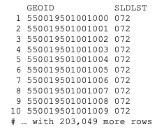
They look like this, with a column showing each census block number and another column showing a legislative district assignment. In Wisconsin, this is what a redistricting plan actually looks like.
After joining the Assembly district codes to the census block shapes, we can map all the individual blocks that make up a district. Here is the 18th district, on the west side of Milwaukee and stretching into eastern Wauwatosa. The large square in the center is Washington Park.
See here for more details and access to the source data files.
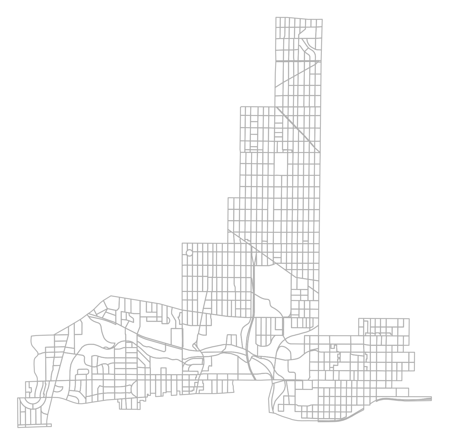
We could conclude that this district is entirely contiguous using the eye-test alone. Sometimes, it’s more difficult to tell. In any case, examining all 132 state legislative districts separately would quickly become tedious. Fortunately, we can also measure this more formally using a set of open-source GIS and network analysis tools.
My code performing this analysis is available here in the files “AnalyzeAssembly.R” and “AnalyzeSenate.R.”
First, I subset all the census blocks in a given district. For each census block, I identify all of its neighboring blocks. Then, I turn that block adjacency list into a graph. Each graph consists of one or more components.
In a fully contiguous graph, such as that of Assembly District 18, there is just 1 component.
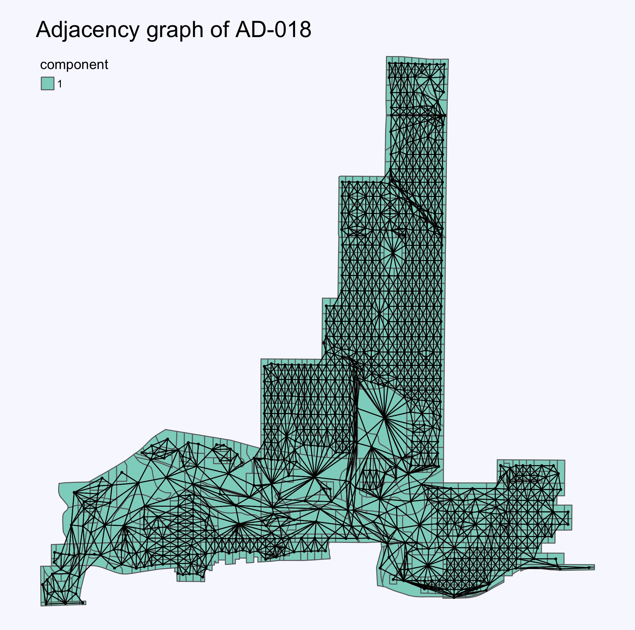
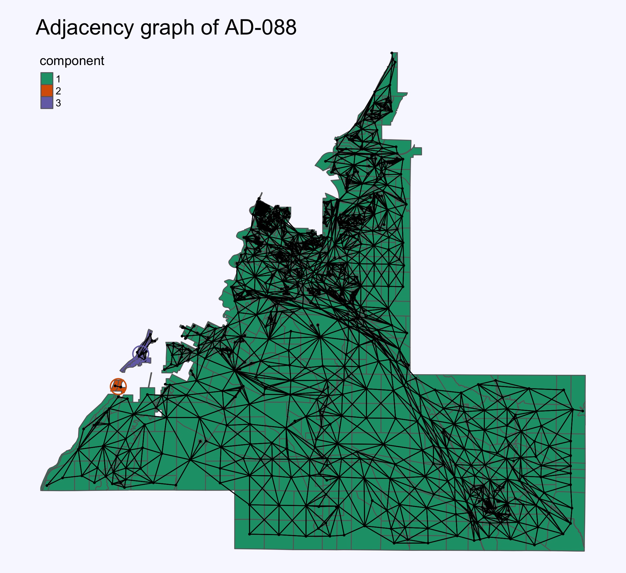
The 88th Assembly District, on the other hand, consists of 3 components. In other words, there are 3 sections of AD-88 that don’t touch the other sections.
Literal islands
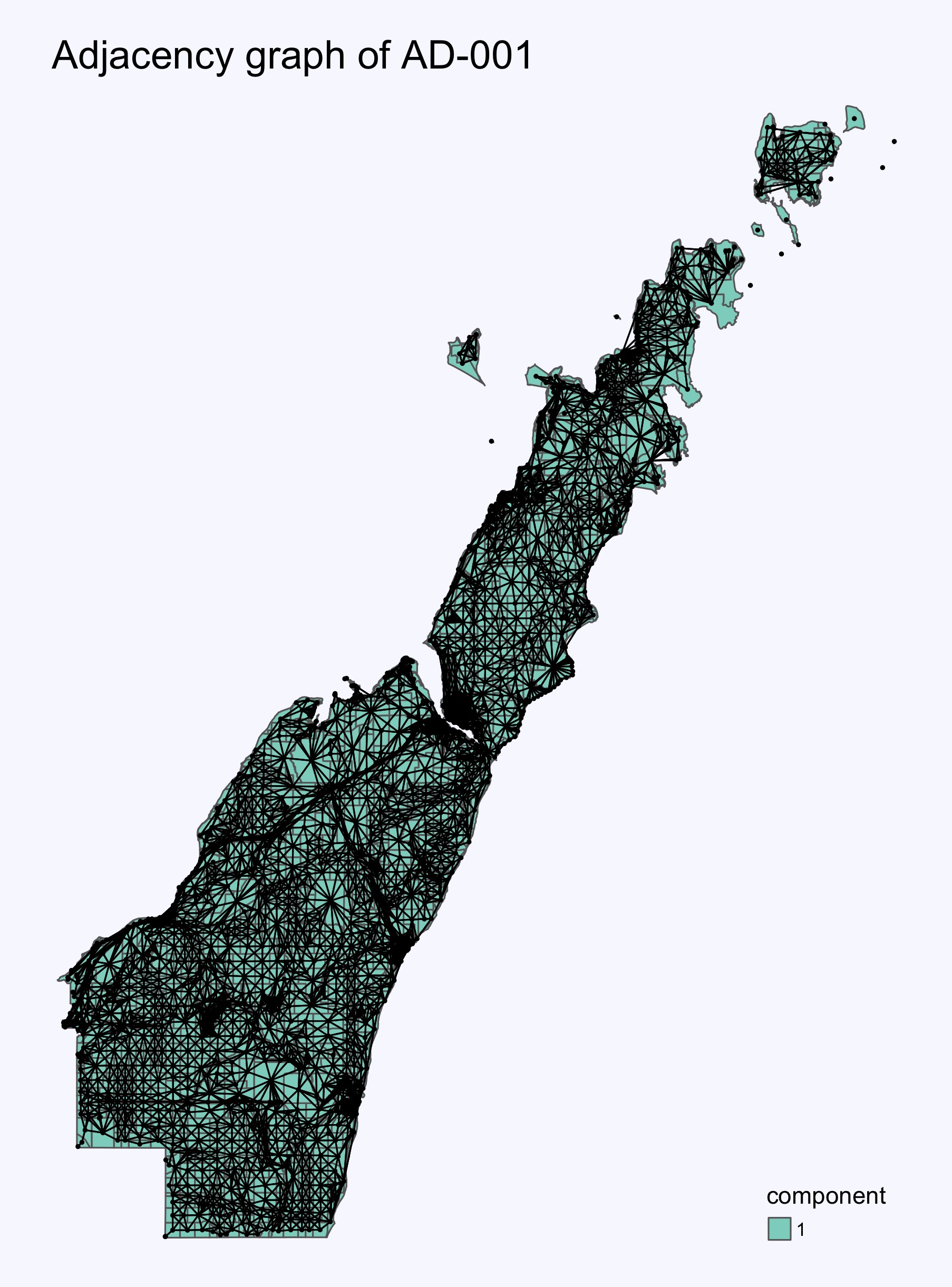
Recall that water-only census blocks aren’t assigned to a legislative district. To accommodate actual islands, I allowed the network analysis to identify graph components using the aquatic blocks as connectors, but I do not plot these blocks themselves. For example, here is the adjacency graph for AD-1 (Door County).
Notice that the offshore islands are assigned to component #1, even though they obviously can’t physically touch the mainland. So this district is fully contiguous.
Summary
You can view my adjacency graphs for each Assembly and Senate district here.
Files showing each census block’s district and network-component-within-district are available here. This directory also includes tables summarizing the results of the network analysis for both the Assembly and Senate, along with accompanying documentation.
In total, 52 Assembly districts and 21 Senate districts are noncontiguous. Of those Assembly districts, 41 include some number of residents in at least two unconnected sections, as do 16 of the Senate districts.
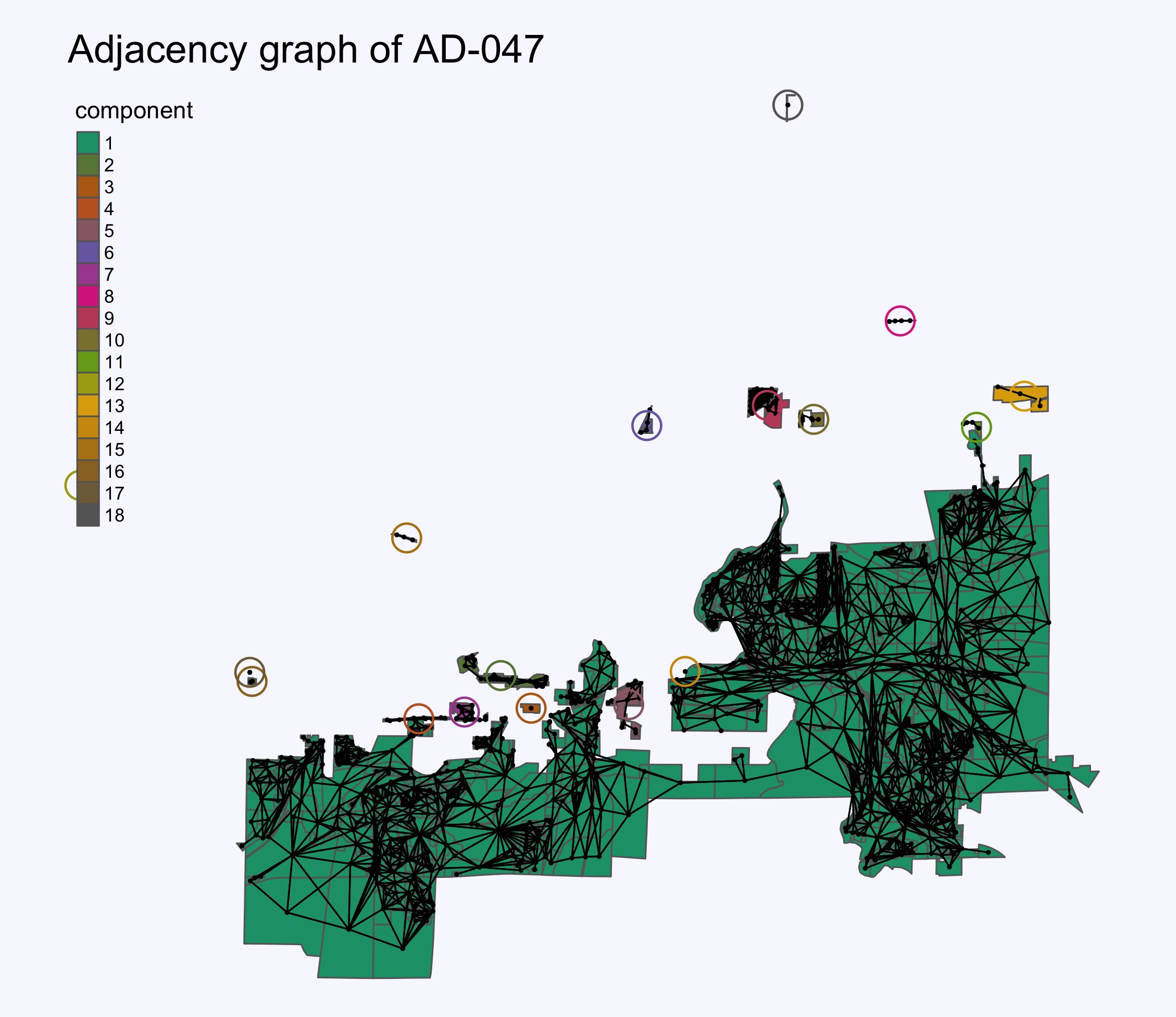
The Assembly district with the largest disconnected population is the 47th, to the south of Madison. According to the 2020 census, 3,737 residents live outside the district’s main component. The 47th district also includes the largest number of census blocks outside the main component, both in total (129) and in populated blocks (61).
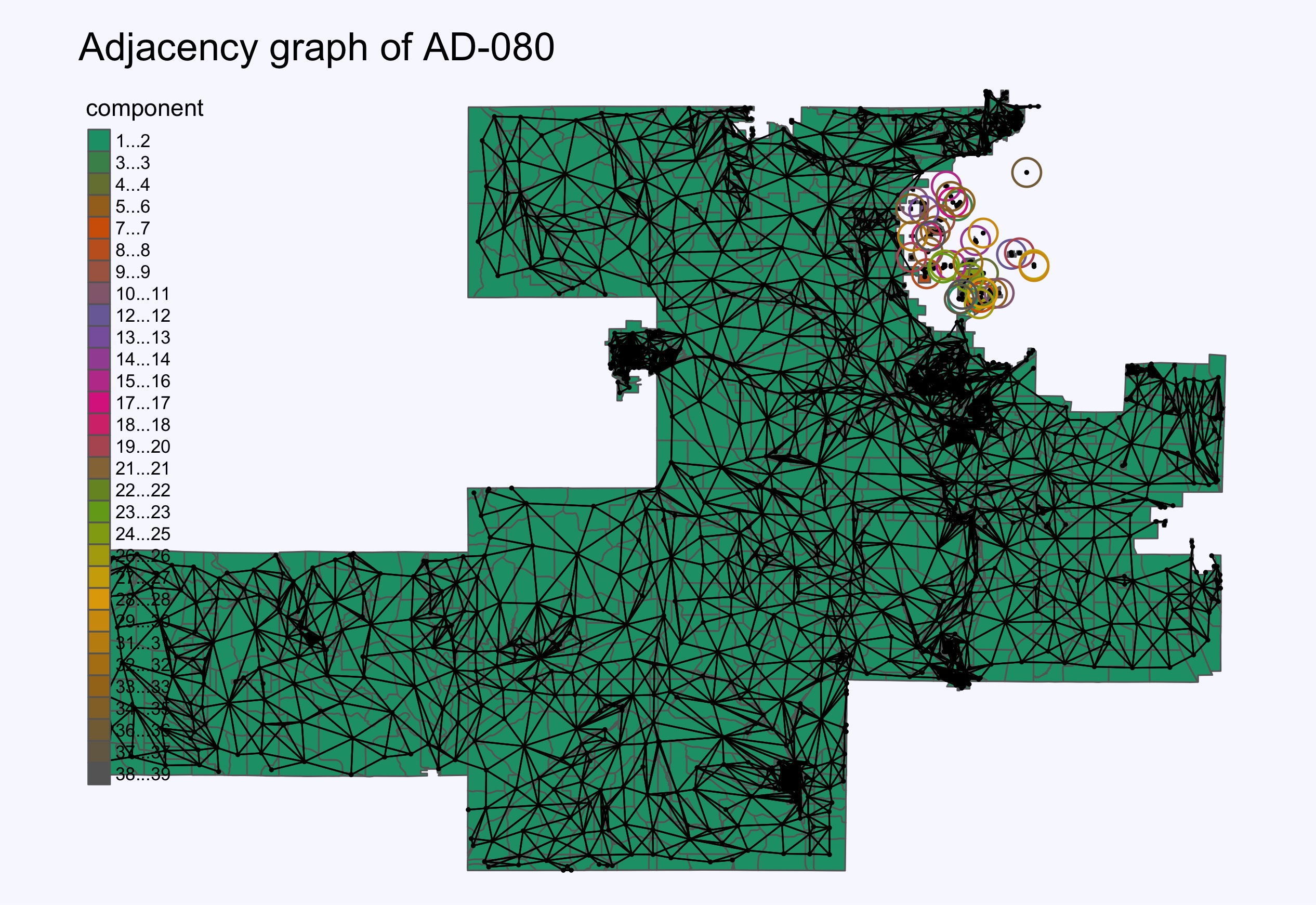
Nearby Assembly District 80 contains the largest total number of unconnected components, at 38 (not counting the primary component), although only 418 people live in these areas.
In the State Senate, district 16 has the largest population living outside the main component (2,282). The 27th Senate district contains the most unconnected components (32).
Overall, the 2020 census shows 7,953 Wisconsin residents living outside the main component of an Assembly district and 4,872 in an unconnected section of a Senate district.
Thank you for explaining this in a way that’s understandable to an outsider not familiar with the history and details of the controversy. It seems to me that the court sidestepped the real issue and chose instead to reverse what many would consider ‘settled law.’ It is sad to see political factions swap sides on issues based when it is politically expedient. I have no doubt that current boundaries are gerrymandered to benefit the Republican party. But I’m also convinced the court majority wouldn’t care about contiguousness if the boundaries were more fair.